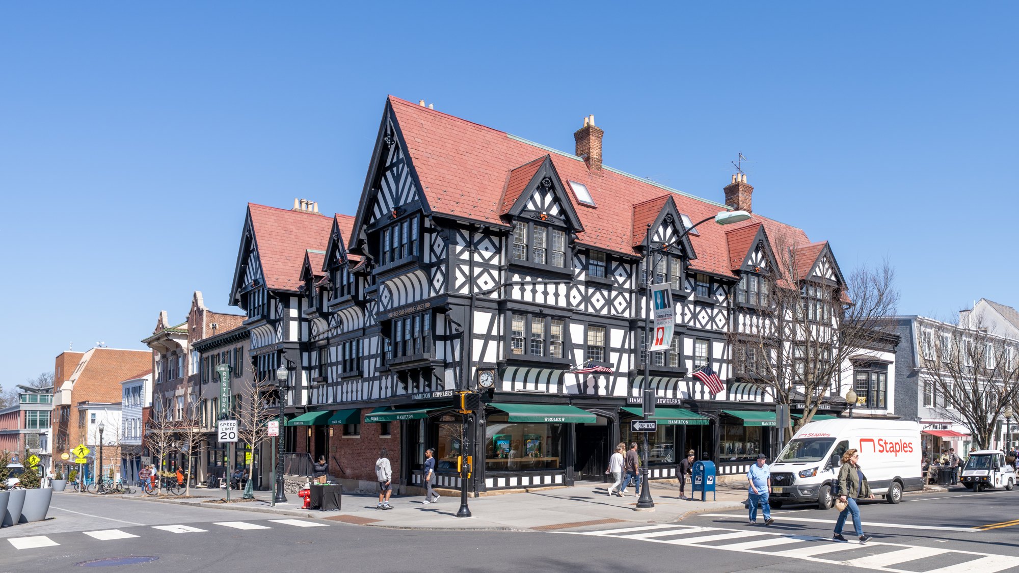
Historic Nassau Street architecture in Princeton

Outdoors

Biking and mountain biking near Princeton

Trails and recreation areas near Princeton open to biking and mountain biking.

16places to ride
36 mito the closest
March–June, August–Novemberbest months

Good to know: Wilderness areas are closed to bikes; check each area’s trail rules and yield to hikers and horses.

Closest picks

1

Camp Gateway - Sandy Hook

36 mi east · National Park Service

Welcome to Gateway National Recreation Area, Sandy Hook Unit! There are a variety of cultural and recreational opportunities available at the park including history tours, living history demonstrations, hiking, birding, kayaking, camping,…
2

Camp Gateway - Staten Island

36 mi northeast · National Park Service

This campground boasts a spectacular view of the Verrazzano-Narrows Bridge, the longest vehicle suspension span in the United States. When it opened in 1964, it was the longest span in the world for 17 years.

3

National Parks of New York Harbor

39 mi northeast · National Park Service

These 12 sites preserve more than 400 years of American history! We invite you to explore the past and investigate its relevance in our lives today.

Map of all 16 places

Map of 16 places loads as you scroll.

30 to 75 miles (14)

36 mi east · National Park Service · Campground

Camp Gateway - Sandy Hook

Welcome to Gateway National Recreation Area, Sandy Hook Unit! There are a variety of cultural and recreational opportunities available at the park including history tours, living history demonstrations, hiking, birding, kayaking, camping,…

  • Biking
  • Birding
  • Boating
  • Camping
  • Canoeing
  • Cultural Activities
  • Evening Programs
  • Fishing

36 mi northeast · National Park Service · Campground

Camp Gateway - Staten Island

This campground boasts a spectacular view of the Verrazzano-Narrows Bridge, the longest vehicle suspension span in the United States. When it opened in 1964, it was the longest span in the world for 17 years.

  • Biking
  • Birding
  • Boating
  • Camping
  • Evening Programs
  • Fishing
  • Guided Interpretive Walks
  • Hiking

39 mi northeast · National Park Service

National Parks of New York Harbor

These 12 sites preserve more than 400 years of American history! We invite you to explore the past and investigate its relevance in our lives today.

  • Biking
  • Boating
  • Camping
  • Fishing
  • Hiking
  • History
  • Paddling
  • Picnicking

41 mi northeast · National Park Service

Governors Island National Monument

From 1794 to 1966, the U.S. Army presence on Governors Island played a vital role in the social, political, and economic life of New York City. The island then served as the headquarters of the U.S.

  • Biking
  • Picnicking

42 mi east · National Park Service

Gateway National Recreation Area

Spanning 27,000 acres from Sandy Hook in New Jersey to Breezy Point in New York City, the park is both the gateway from the ocean into New York Harbor, and the gateway to the National Park Service for millions of visitors every year.

  • Biking
  • Boating
  • Camping
  • Fishing
  • Paddling
  • Swimming

44 mi east · National Park Service · Campground

Camp Gateway- Brooklyn Ny

There's no other campground in the world where a family can sleep under the stars, tour the Statue of Liberty, watch a Broadway musical and kayak in one of the world's premier bird migration sanctuaries-all in one trip.

  • Archery
  • Biking
  • Camping
  • Fishing
  • Hiking
  • Horseback riding
  • Ranger programs
  • Star Gazing

45 mi southwest · National Park Service

Valley Forge National Historical Park

Refuge. Resolve. Renewal. Valley Forge is the place where George Washington and the Continental Army took refuge during the winter of 1777-1778.

  • Biking
  • Hiking
  • History
  • Wildlife viewing

55 mi north · National Park Service

Delaware Water Gap National Recreation Area

Situated within the most densely populated region of the United States, Delaware Water Gap National Recreation Area provides a unique opportunity to experience tranquil landscapes, rich human history, and striking scenery along 40 miles of…

  • Biking
  • Boating
  • Climbing
  • Fishing
  • Hiking
  • History
  • Horseback riding
  • Hunting

55 mi south · National Oceanic and Atmospheric Administration

Jacques Cousteau National Estuarine Research Reserve

The Jacques Cousteau National Estuarine Research Reserve, at Mullica River and Great Bay, is the only reserve in the national system to be named after an individual.

  • Biking
  • Fishing
  • Hiking
  • Paddling
  • Photography
  • Picnicking
  • Swimming

60 mi southwest · National Park Service

First State National Historical Park

Famous as the First State to ratify the Constitution, Delaware was born out of a conflict among three world powers for dominance of the Delaware Valley.

  • Biking
  • Fishing
  • Hiking
  • History
  • Horseback riding
  • Picnicking

61 mi northwest · US Army Corps of Engineers

Beltzville Lake

Beltzville Lake is a 3,600-acre project, having a 947-acre lake. The Corps operates and maintains the dam and a small visitor center.

  • Biking
  • Boating
  • Nature education
  • Picnicking
  • Water sports
  • Wildlife viewing

63 mi south · Fish and Wildlife Service

Edwin B. Forsythe National Wildlife Refuge

Edwin B. Forsythe Refuge was originally two distinct refuges: Brigantine and Barnegat. They were established in 1939 and 1967 respectively, to protect tidal wetland and shallow bay habitat for migratory water birds.

  • Biking
  • Birding
  • Fishing
  • Hiking
  • Hunting
  • Motor Boat
  • Nature education
  • Non-Motorized Boating

71 mi northeast · National Park Service

Sagamore Hill National Historic Site

Sagamore Hill was the home of Theodore Roosevelt, 26th President of the United States, from 1885 until his death in 1919. During Roosevelt's time in office, his "Summer White House" was the focus of international attention.

  • Biking
  • Hiking
  • History
  • Picnicking
  • Wildlife viewing

72 mi west · US Army Corps of Engineers · Campground

Blue Marsh Lake (Dry Brooks Day Use Area)

Located at Blue Marsh Lake northwest of Reading, Pennsylvania, three group picnic shelters are available for reservations within the Dry Brooks Day Use Area.

  • Biking
  • Boating
  • Camping
  • Hiking

75 miles and farther (2)

116 mi northeast · US Army Corps of Engineers · Campground

Hop Brook Lake Recreation Area

Hop Brook Lake Recreation Area is located within the towns of Middlebury, Naugatuck and Waterbury, Connecticut. Its 536 acres provide excellent recreation opportunities and a chance to escape from the growing suburbia surrounding the park.

  • Biking
  • Boating
  • Camping
  • Canoeing
  • Cross Country Skiing
  • Fishing
  • Hiking
  • Kayaking

123 mi northeast · US Army Corps of Engineers · Campground

Northfield Brook Lake Group Shelters

Northfield Brook Lake Group Shelters are located along a small scenic lake in the Naugatuck Valley of west-central Connecticut.

  • Biking
  • Birding
  • Camping
  • Canoeing
  • Fishing
  • Hiking
  • History
  • Kayaking

Distances are straight-line miles from downtown Princeton. Listings come from Recreation.gov’s federal recreation database; check each official page for hours, fees, fire restrictions and closures before you go.

Get outside around Princeton

Things to do in New Jersey | Explore Princeton video thumbnail

THINGS TO DO · YOUTUBE SHORT

Things to do in New Jersey | Explore Princeton

A local activity Short shared by Papali Dash.

Watch on YouTube ↗

Around Princeton

View north down the Millstone River from the New Jersey State Route 27 bridge on the border of Princeton, Mercer County and
2023-10-01 16 04 26 View north down the Millstone River from the New Jersey State Route 27 bridge on the border of Princeton, Mercer County and Franklin Township, Somerset County in New JerseyFamartin · CC BY-SA 4.0
McCormick Hall, Princeton University Art Museum, Princeton University Campus, Princeton, New Jersey, USA
McCormick Hall, Princeton University Art Museum, Princeton University Campus, Princeton, New Jersey, USAGary Miotla · CC BY 3.0
View south along Quaker Road (Mercer County Route 533) at Parkside Drive in Princeton, Mercer County, New Jersey
2017-09-12 17 27 10 View south along Quaker Road (Mercer County Route 533) at Parkside Drive in Princeton, Mercer County, New JerseyFamartin · CC BY-SA 4.0

More outdoors near Princeton

Questions

Where is the closest place for biking near Princeton?

Camp Gateway - Sandy Hook (National Park Service), about 36 miles east of Princeton as the crow flies. Next are Camp Gateway - Staten Island (36 mi) and National Parks of New York Harbor (39 mi).

When is the best time for biking near Princeton?

Based on Princeton’s average highs, March–June, August–November. Conditions at higher elevations can be much cooler.

Who manages these places?

Federal agencies including National Park Service, US Army Corps of Engineers, National Oceanic and Atmospheric Administration. Each listing links to its official page for hours, fees, closures and current conditions.

Princeton AI

Your Princeton local guide
Hey there!

I'm Princeton AI. Ask about neighborhood food, independent shops, local history or planning a visit.

AI recommendations may be inaccurate. Verify hours and prices. Questions are processed by Cloudflare. Privacy